2021
SK0370 : Axe Edge Trig Point
taken 2 years ago, near to Burbage, Derbyshire, England
This is 1 of 2 images, with title Axe Edge Trig Point in this square
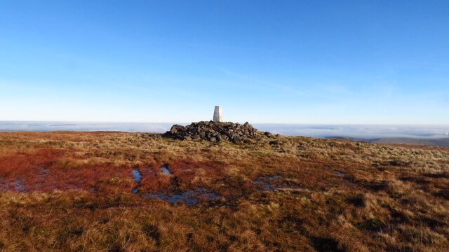
Axe Edge Trig Point
Even on this December day, the summit was warm enough for a leisurely lunch stop. A cold air inversion covers much of the Peak District.
 Map © Crown Copyright")
TIP: Click the map for more Large scale mapping
- Grid Square
- SK0370, 22 images (more nearby 🔍)
- Photographer
- Colin Park (more nearby)
- Date Taken
- Sunday, 19 December, 2021 (more nearby)
- Submitted
- Wednesday, 22 December, 2021
- Subject Location
-
OSGB36:
 SK 0350 7060 [10m precision]
WGS84: 53:13.9455N 1:56.9415W - Camera Location
-
OSGB36: SK 0348 7059
- View Direction
- Northeast (about 45 degrees)