2022
NY9840 : A victim of storm Arwen?
taken 2 years ago, near to Crawleyside, County Durham, England
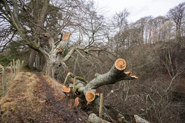
A victim of storm Arwen?
The broken tree is alongside a path at the western rim of the valley of the Stanhope Burn; it appears to have suffered damage prior to the recent episode and there's evidence of rot being exposed too; all the same, with the tree being firmly rooted, it looks as if its life will continue. The fall of part of the tree presumably obstructed the path and clearly, chainsaw work has been needed to clear it.
New Year's Day 2022
A collection of photographs (just one from each contributor) taken on New Year's Day 2022 by Geographers from all over Great Britain, Ireland and the Isle of Man.
View all the photos on a map here: Link
 Map © Crown Copyright")
TIP: Click the map for more Large scale mapping
- Grid Square
- NY9840, 48 images (more nearby 🔍)
- Photographer
- Trevor Littlewood (more nearby)
- Date Taken
- Saturday, 1 January, 2022 (more nearby)
- Submitted
- Saturday, 1 January, 2022
- Subject Location
-
OSGB36:
 NY 9871 4020 [10m precision]
WGS84: 54:45.4045N 2:1.2940W - Camera Location
-
OSGB36: NY 9872 4019
- View Direction
- Northwest (about 315 degrees)