2022
NS9565 : White Burn joining the River Almond
taken 2 years ago, near to East Whitburn, West Lothian, Scotland
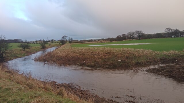
White Burn joining the River Almond
Until recently I had always assumed that the small town of Whitburn took its name from a description of the River Almond, which, while really more of a large stream at this point, is still by far the largest watercourse in its vicinity. What did strike me as odd though, was that the slightly smaller town of Blackburn, a couple of miles East along the same road, and sitting even closer to the Almond, has a diametrically opposite name.
It seems fairly certain that Blackburn takes its name from a description of the River Almond, as the old village sat very close to its banks, and there is no Black Burn nearby. Whitburn, however, would appear to have taken its name from this not-at-all white burn on the right of the picture. I do still have slight doubts due to its small size and the fact that the old village of Whitburn, which was formerly just a row of houses East and West of its central crossroads, was quite a bit closer to the river than the burn. However, old maps show that the old church was sited right next to White Burn, which changes its name from Mole's Burn (or Cultrig Burn depending on the age of the map) at that point, so the White Burn theory seems most likely.
The village of East Whitburn also sits very close to White Burn, so its name might not actually be referencing its position with regard to its larger neighbour, as is commonly assumed, but just from a description of the burn at that point.
The high embankments on both sides of the Almond around here look to be man-made, no doubt to mitigate the impact of flooding on the surrounding farmland.
 Map © Crown Copyright")
TIP: Click the map for more Large scale mapping
- Grid Square
- NS9565, 16 images (more nearby 🔍)
- Photographer
- Ian Dodds (more nearby)
- Date Taken
- Saturday, 8 January, 2022 (more nearby)
- Submitted
- Monday, 10 January, 2022
- Subject Location
-
OSGB36:
 NS 9582 6556 [10m precision]
WGS84: 55:52.3143N 3:39.9912W - Camera Location
-
OSGB36: NS 9582 6556
- View Direction
- EAST (about 90 degrees)