2022
SO5809 : Modern Boundary Stone, Milkwall
taken 2 years ago, near to Milkwall, Gloucestershire, England
This is 1 of 2 images, with title Modern Boundary Stone, Milkwall in this square
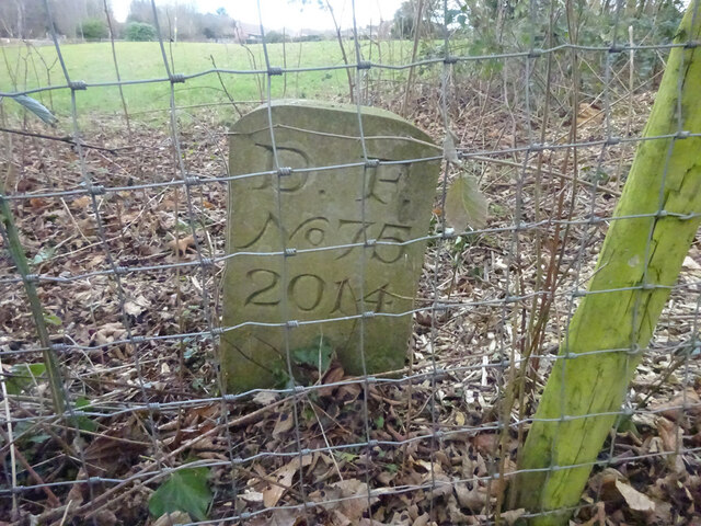
Modern Boundary Stone, Milkwall
Between Perrygrove Rd (B4228) and the junction of Lambquay and Tufthorn Roads. In the field to the North of the track. This is one of 4 modern BS placed at the instigation of the previous owner of the nearby bungalow along the track to the South (8 years ago). They replace much older BS seen on older maps. This one delineates the Coleford and West Dean parish boundary. see also Link & Link & Link
Inscription: D. F. / Nᴼ 75 / 2014
Milestone Society National ID: GL_DFWDCO75em
Inscription: D. F. / Nᴼ 75 / 2014
Milestone Society National ID: GL_DFWDCO75em
National Survey of Wayside Features by The Milestone Society
These images are from Link
Forest of Dean Boundary Stones
a list of 100 (so far, of 200) FoD BS on Geograph see Link . An interactive map of them is Link

Some are Gale (mining rights) Stones see Facebook Link
 Map © Crown Copyright")
TIP: Click the map for more Large scale mapping
- Grid Square
- SO5809, 95 images (more nearby 🔍)
- Photographer
- Mr Red (more nearby)
- Date Taken
- Tuesday, 1 February, 2022 (more nearby)
- Submitted
- Wednesday, 2 February, 2022
- Subject Location
-
OSGB36:
 SO 58093 09227 [1m precision]
WGS84: 51:46.8077N 2:36.5313W - Camera Location
-
OSGB36: SO 58093 09227
- View Direction
- NORTH (about 0 degrees)