2022
TA1625 : A Fine Rocky Bottom
taken 2 years ago, near to Paull, East Riding of Yorkshire, England
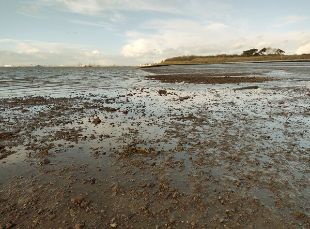
A Fine Rocky Bottom
This was a particularly low tide day (I was there at its lowest point) and was able to get about 100m away from the Humber embankment. Once I'd passed the muddy rocks covered in seaweed, this was constituency of the river bed. It's almost like crushed concrete with a porous surface and is easy to walk on. Anybody out there know what type of rock this is please?
 Map © Crown Copyright")
TIP: Click the map for more Large scale mapping
- Grid Square
- TA1625, 97 images (more nearby 🔍)
- Photographer
- Andy Beecroft (more nearby)
- Date Taken
- Friday, 4 February, 2022 (more nearby)
- Submitted
- Saturday, 5 February, 2022
- Subject Location
-
OSGB36:
 TA 167 257 [100m precision]
WGS84: 53:42.8803N 0:13.9728W - Camera Location
-
OSGB36: TA 169 250
- View Direction
- North-northwest (about 337 degrees)