2022
SJ3074 : Hampston Well, Burton
taken 2 years ago, near to Burton, Cheshire West And Chester, England
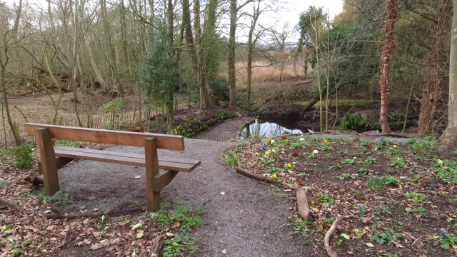
Hampston Well, Burton
The well is said to date from Iron Age times and there are several references to the upkeep of the well since the 1600s. The well was originally called Patricks Well but became known as Hampstons Well after a local family that lived nearby since the 16th century. the area around the well has recently been landscaped.
 Map © Crown Copyright")
TIP: Click the map for more Large scale mapping
- Grid Square
- SJ3074, 49 images (more nearby 🔍)
- Photographer
- Colin Park (more nearby)
- Date Taken
- Thursday, 3 February, 2022 (more nearby)
- Submitted
- Tuesday, 8 February, 2022
- Subject Location
-
OSGB36:
 SJ 3099 7431 [10m precision]
WGS84: 53:15.6769N 3:2.1604W - Camera Location
-
OSGB36: SJ 3100 7431
- View Direction
- West-southwest (about 247 degrees)