2022
NK1250 : Kirkton Head
taken 2 years ago, near to Lunderton, Aberdeenshire, Scotland
This is 1 of 3 images, with title Kirkton Head in this square
Kirkton Head
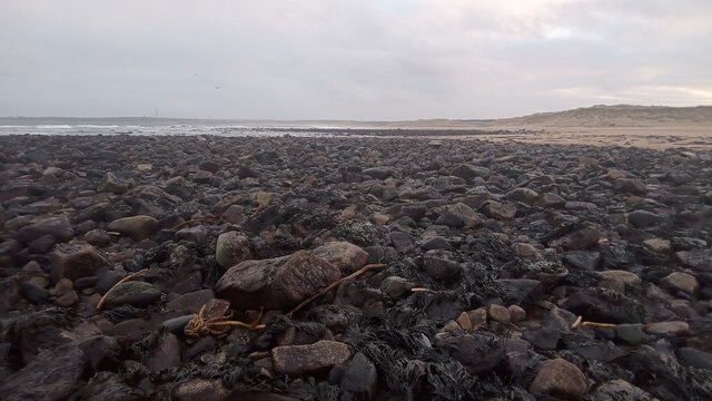
The OS maps show Kirkton Head and Black Stones as being part of the same natural feature, but as can be seen here, although they are very close to one another, there is a short sandy stretch between them. The stones on Black Stones (which is directly ahead in the picture) are far darker when you get up close, but from a distance both look the same colour. This is due to the stones being covered with a dark green stringy variety of seaweed.
The picture was taken about an hour before low tide - this low tide was listed as being a foot or so lower than the previous low tide.
The picture was taken about an hour before low tide - this low tide was listed as being a foot or so lower than the previous low tide.
 Map © Crown Copyright")
TIP: Click the map for more Large scale mapping
- Grid Square
- NK1250, 5 images (more nearby 🔍)
- Photographer
- Ian Dodds (more nearby)
- Date Taken
- Monday, 14 February, 2022 (more nearby)
- Submitted
- Monday, 14 February, 2022
- Subject Location
-
OSGB36:
 NK 1208 5049 [10m precision]
WGS84: 57:32.6625N 1:47.9911W - Camera Location
-
OSGB36: NK 1208 5049
- View Direction
- SOUTH (about 180 degrees)