SH5860 : Llanberis Lake Railway, Gilfach Ddu
taken 2 years ago, near to Llanberis, Gwynedd, Wales
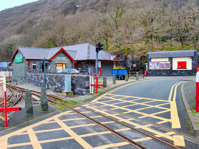
The Llanberis Lake Railway (Rheilffordd Llyn Padarn) is a narrow gauge heritage railway that runs for 2½ miles along the northern shore of Llyn Padarn. The starting point is the village of Llanberis at the eastern end of the lake, with the western terminus at Pen Llyn in the Padarn Country Park. The return journey takes around 60 minutes.
The Llanberis Lake Railway runs along part of the trackbed of the now defunct Padarn Railway which connected the quarry with Y Felinheli (Port Dinorwic) on the Menai Strait. The Padarn Railway closed in October 1961 and was lifted between 16 May 1962 and February 1963.
When the quarry closed at short notice in July 1969, the lakeside section of the trackbed was utilised for the current Llanberis Lake Railway, originally running from the National Slate Museum at Gilfach Ddu. The railway officially opened on 28 May 1971 but the first public trains did not run until 19 July 1971. In the winter of 1971 the railway was extended to its current terminus at Penllyn. In June 2003 the railway was extended to Llanberis, with a new station close to the start of the Snowdon Mountain Railway. The original terminus at Gilfach Ddu is now a through station serving both the National Slate Museum and the nearby Dolbadarn Castle.
 Map © Crown Copyright")
- Grid Square
- SH5860, 519 images (more nearby 🔍)
- Photographer
- David Dixon (more nearby)
- Date Taken
- Tuesday, 15 February, 2022 (more nearby)
- Submitted
- Saturday, 12 March, 2022
- Subject Location
-
OSGB36:
 SH 585 604 [100m precision]
WGS84: 53:7.3230N 4:6.8948W - Camera Location
-
OSGB36: SH 585 603
- View Direction
- NORTH (about 0 degrees)