SK8770 : All Saints' church
taken 2 years ago, near to Harby, Nottinghamshire, England
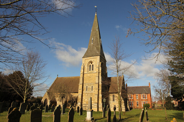
Grade II listed.
The current church was built slightly to the north of an existing building in 1877, when the old church was demolished.
There was a church here in the late 13th C and in November 1290 Queen Eleanor, wife of Edward I, died at the nearby manor of Richard de Weston.
King Edward I founded a Chantry Chapel, which was incorporated into the parish church and survived until 1548.
The church became a Chapel of Ease to the church of St George, North Clifton, and was only a simple rectangular building.
By 1868 a fund for a new church was started, and the foundation stone was laid in 1874, the architect being John Lee of London. The church was completed in 1877.
The church consists of an aisleless nave, chancel, a south tower with broach spire, south porch and a north vestry.
There are six bells.
The chancel is several steps above the nave, with a sedilia and piscina. There is a glass mosaic reredos by James Powell & Sons. The triple lancet east window is by Heaton, Butler and Bayne. They also decorated the organ pipes.
There is a stone pulpit base, with brass railings, and an eagle lectern.
The original 15th century octagonal font from the old church has been retained.
There is a memorial window to Queen Eleanor by Lincoln Cathedral artist Stephen Lewis, installed in 2008.
 Map © Crown Copyright")
- Grid Square
- SK8770, 565 images (more nearby 🔍)
- Photographer
- Richard Croft (more nearby)
- Date Taken
- Tuesday, 1 March, 2022 (more nearby)
- Submitted
- Tuesday, 15 March, 2022
- Subject Location
-
OSGB36:
 SK 8781 7050 [10m precision]
WGS84: 53:13.4580N 0:41.1718W - Camera Location
-
OSGB36: SK 8781 7047
- View Direction
- NORTH (about 0 degrees)