1969
TQ2996 : Trent Park, London N14
taken 54 years ago, near to Cockfosters, Enfield, England
This is 1 of 24 images, with title Trent Park, London N14 in this square
Trent Park, London N14
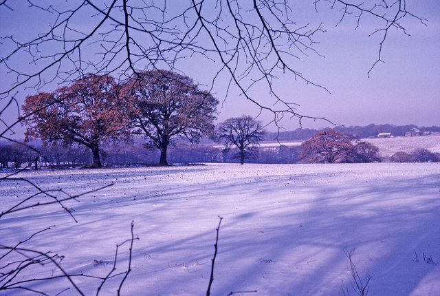
This image was taken from Bramley Road looking across the open land where the golf clubhouse and golf course are now situated. On the left of the image one of the oak trees remains, but there is now a line of conifers.
 Map © Crown Copyright")
TIP: Click the map for more Large scale mapping
- Grid Square
- TQ2996, 408 images (more nearby 🔍)
- Photographer
- Christine Matthews (more nearby)
- Date Taken
- 30 November 1969 (more nearby)
- Submitted
- Monday, 3 March, 2008
- Subject Location
-
OSGB36:
 TQ 292 964 [100m precision]
WGS84: 51:39.1139N 0:7.9692W - Camera Location
-
OSGB36: TQ 294 961
- View Direction
- North-northwest (about 337 degrees)