2022
ST7715 : Stour Valley Way by the Stour
taken 2 years ago, near to Hinton st Mary, Dorset, England
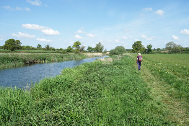
Stour Valley Way by the Stour
A lovely open section of walking right beside the river which, despite its name, the Stour Valley Way rarely achieves. I guess this bit of path gets flooded from time to time. A nearby section of the Hardy Way long distance path by-passes it on higher ground if that happens.
 Map © Crown Copyright")
TIP: Click the map for more Large scale mapping
- Grid Square
- ST7715, 23 images (more nearby 🔍)
- Photographer
- Des Blenkinsopp (more nearby)
- Date Taken
- Sunday, 8 May, 2022 (more nearby)
- Submitted
- Thursday, 12 May, 2022
- Subject Location
-
OSGB36:
 ST 7765 1573 [10m precision]
WGS84: 50:56.4344N 2:19.1683W - Camera Location
-
OSGB36: ST 7767 1566
- View Direction
- North-northwest (about 337 degrees)