J3731 : Access path to Bryansford Avenue across the Section 'C' embankment
taken 2 years ago, near to Newcastle, Co Down, Northern Ireland
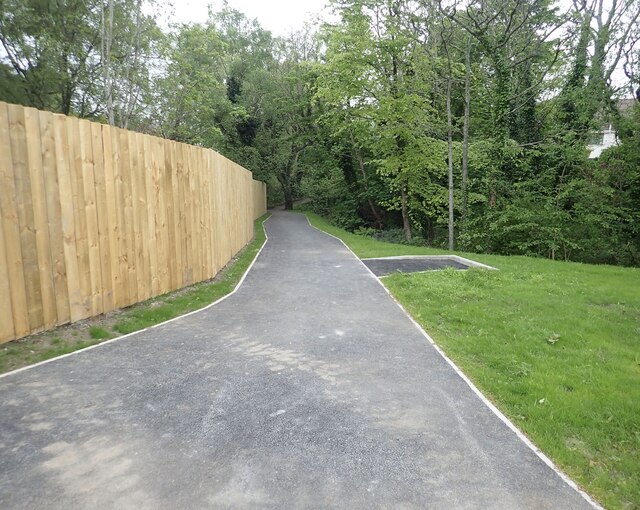
Access path to Bryansford Avenue across the Section 'C' embankment
Before the embankment was built the path ran at the same level as the stream on the right which after heavy rain would often flood the path.
Link
Link
The Shimna Flood Alleviation Scheme
This 5.5 million NI Government Scheme is designed to alleviate the periodic flooding incidents in the basins of the Shimna and Tullybranigan Rivers. A similar scheme on the Burren, a tributary of the Shimna, was successfully completed almost two decades ago. The work is undertaken by the Ballynahinch company of Dawson Wam, a leading firm in this field.
![Creative Commons Licence [Some Rights Reserved]](https://s1.geograph.org.uk/img/somerights20.gif)
|
· Find out How to reuse this image ·
Share:
|
|||||
| Start a discussion on J3731 | Suggest an update to this image | Contact the contributor | |||
Loading map... (JavaScript required)
- Grid Square
- J3731, 1849 images (more nearby
 )
)
- Photographer
- Eric Jones (find more nearby)
- Date Taken
- Sunday, 15 May, 2022 (more nearby)
- Submitted
- Wednesday, 18 May, 2022
- Geographical Context
- Subject Location
-
Irish:
 J 3719 3162 [10m precision]
WGS84: 54:12.9094N 5:53.8637W - Camera Location
-
Irish: J 3720 3159
- View Direction
- North-northwest (about 337 degrees)
This page has been viewed about 23 times.
View this location:
KML (Google Earth) ·
Google Maps ·
Bing Maps ·
Geograph Coverage Map ·
More Links for this image
·
Bing Maps ·
Geograph Coverage Map ·
More Links for this image