2021
SU5599 : Nuneham Courtenay
taken 3 years ago, near to Nuneham Courtenay, Oxfordshire, England
This is 1 of 6 images, with title Nuneham Courtenay in this square
Nuneham Courtenay
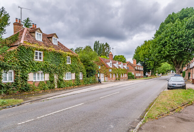
Mid 18th Century cottages on the A4074 through Nuneham Courtenay, built as part of a replacement village by the 1st Earl Harcourt when he built Nuneham House in around 1760, demolishing the old village to make way for the house and landscaped grounds. The three buildings here, nos 1 & 2 (nearest), then nos 3 & 4 and then nos 5 & 6 (beyond) are all grade II listed - see Link Link and Link respectively - as are most of the buildings in the village.
 Map © Crown Copyright")
TIP: Click the map for more Large scale mapping
- Grid Square
- SU5599, 95 images (more nearby 🔍)
- Photographer
- Ian Capper (more nearby)
- Date Taken
- Friday, 10 September, 2021 (more nearby)
- Submitted
- Thursday, 19 May, 2022
- Subject Location
-
OSGB36:
 SU 553 990 [100m precision]
WGS84: 51:41.2383N 1:12.0245W - Camera Location
-
OSGB36: SU 553 990
- View Direction
- Northwest (about 315 degrees)