2022
TQ4180 : Docklands Light Railway east of Prince Regent
taken 2 years ago, near to London City Airport, Newham, England
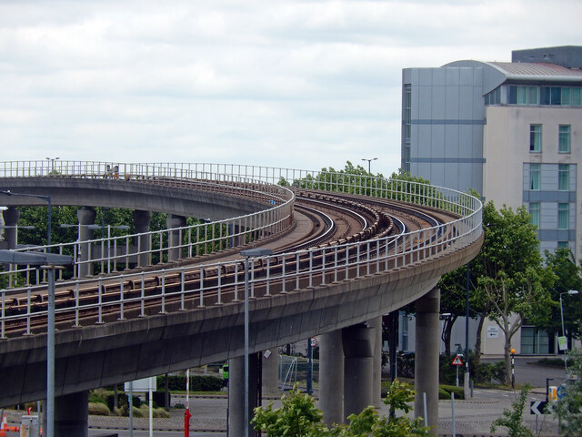
Docklands Light Railway east of Prince Regent
Seen from the London Excel the Docklands Light Railway sweeps across this viaduct between Prince Regent and Royal Albert stations on the Beckton branch opened in 1994.
 Map © Crown Copyright")
TIP: Click the map for more Large scale mapping
- Grid Square
- TQ4180, 383 images (more nearby 🔍)
- Photographer
- Stephen McKay (more nearby)
- Date Taken
- Thursday, 26 May, 2022 (more nearby)
- Submitted
- Sunday, 29 May, 2022
- Subject Location
-
OSGB36:
 TQ 4148 8078 [10m precision]
WGS84: 51:30.4947N 0:2.2353E - Camera Location
-
OSGB36: TQ 4129 8085
- View Direction
- East-southeast (about 112 degrees)