2022
NG5917 : Bridge over Allt a' Ghairuillt
taken 2 years ago, 3 km from Kilbride/Cille Bhrighde, Isle of Skye, Scotland
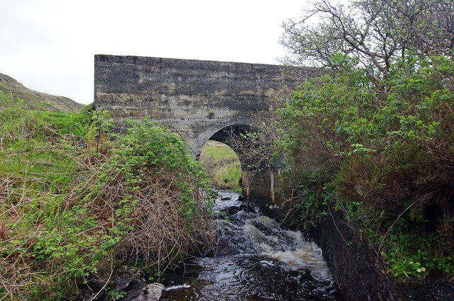
Bridge over Allt a' Ghairuillt
Concrete bridge carries the track from Kilbride to Suisnish.
 Map © Crown Copyright")
TIP: Click the map for more Large scale mapping
- Grid Square
- NG5917, 10 images (more nearby 🔍)
- Photographer
- Ian Taylor (more nearby)
- Date Taken
- Thursday, 19 May, 2022 (more nearby)
- Submitted
- Monday, 30 May, 2022
- Subject Location
-
OSGB36:
 NG 5901 1767 [10m precision]
WGS84: 57:11.1780N 5:59.3908W - Camera Location
-
OSGB36: NG 5900 1767
- View Direction
- East-northeast (about 67 degrees)