2022
NF6906 : Tràigh Eais with dunes
taken 2 years ago, near to Barra Airport, Barra, Na h-Eileanan an Iar, Scotland
This is 1 of 8 images, with title starting with Traigh Eais in this square
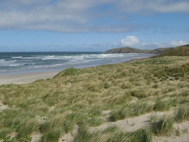
Tràigh Eais with dunes
The western side of what is apparently a tombolo between the principal island of Barra and a northern upland tract comprising Eòlaigearraidh and Sgurabhal.
 Map © Crown Copyright")
TIP: Click the map for more Large scale mapping
- Grid Square
- NF6906, 31 images (more nearby 🔍)
- Photographer
- Jonathan Wilkins (more nearby)
- Date Taken
- Wednesday, 11 May, 2022 (more nearby)
- Submitted
- Wednesday, 1 June, 2022
- Subject Location
-
OSGB36:
 NF 692 064 [100m precision]
WGS84: 57:1.8185N 7:27.2041W - Camera Location
-
OSGB36: NF 692 060
- View Direction
- NORTH (about 0 degrees)