2022
NH9857 : Ordnance Survey Cut Mark with Rivet
taken 2 years ago, near to Dyke, Moray, Scotland
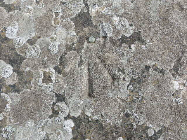
Ordnance Survey Cut Mark with Rivet
This mark and rivet can be found on the parapet top of Barley mill Bridge.
The recorded details give a height of 21.3036 metres above sea level.
For more detail see : Link
The recorded details give a height of 21.3036 metres above sea level.
For more detail see : Link
 Map © Crown Copyright")
TIP: Click the map for more Large scale mapping
- Grid Square
- NH9857, 66 images (more nearby 🔍)
- Photographer
- Peter Wood (more nearby)
- Date Taken
- Thursday, 12 May, 2022 (more nearby)
- Submitted
- Sunday, 5 June, 2022
- Subject Location
-
OSGB36:
 NH 9869 5752 [10m precision]
WGS84: 57:35.7773N 3:41.7976W