2022
NJ0159 : Ordnance Survey Cut Mark
taken 2 years ago, near to Kintessack, Moray, Scotland
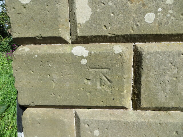
Ordnance Survey Cut Mark
This mark can be found on the entrance pillar to Moy House.
The recorded details give a height of 10.3058 metres above sea level.
For more detail see : Link
The recorded details give a height of 10.3058 metres above sea level.
For more detail see : Link
 Map © Crown Copyright")
TIP: Click the map for more Large scale mapping
- Grid Square
- NJ0159, 29 images (more nearby 🔍)
- Photographer
- Peter Wood (more nearby)
- Date Taken
- Thursday, 12 May, 2022 (more nearby)
- Submitted
- Monday, 6 June, 2022
- Subject Location
-
OSGB36:
 NJ 01321 59766 [1m precision]
WGS84: 57:37.0222N 3:39.2127W