2022
SK5842 : Looking NW along The Wells Road
taken 2 years ago, 3 km from Arnold, Nottinghamshire, England
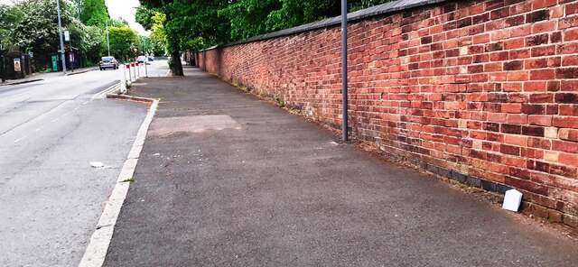
Looking NW along The Wells Road
There is an Ordnance Survey benchmark SK5842 : Benchmark on wall on NE side of The Wells Road opposite entrance to Walter Halls Primary School at the base of the brick wall at the right foreground of the image next to a notebook placed against the wall
 Map © Crown Copyright")
TIP: Click the map for more Large scale mapping
- Grid Square
- SK5842, 108 images (more nearby 🔍)
- Photographer
- Roger Templeman (more nearby)
- Date Taken
- Tuesday, 10 May, 2022 (more nearby)
- Submitted
- Wednesday, 8 June, 2022
- Subject Location
-
OSGB36:
 SK 5851 4279 [10m precision]
WGS84: 52:58.7563N 1:7.8021W - Camera Location
-
OSGB36: SK 5852 4277
- View Direction
- Northwest (about 315 degrees)