2022
TQ3932 : Twelve Acres/Greenwood
taken 2 years ago, near to Wych Cross, East Sussex, England
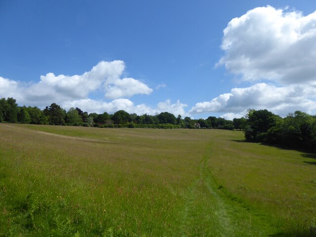
Twelve Acres/Greenwood
The name of the fields according to East Grinstead's 1841 tithe map that have been merged to form a larger unit. Twelve Acres was in the foreground and has been subdivided into two parts, this is the eastern section. Greenwood is beyond the wood to the right. A faint embankment which can just be made out next to the wood on the right is the former medieval pale of Ashdown Forest.
 Map © Crown Copyright")
TIP: Click the map for more Large scale mapping
- Grid Square
- TQ3932, 36 images (more nearby 🔍)
- Photographer
- Simon Carey (more nearby)
- Date Taken
- Sunday, 12 June, 2022 (more nearby)
- Submitted
- Monday, 13 June, 2022
- Subject Location
-
OSGB36:
 TQ 3984 3244 [10m precision]
WGS84: 51:4.4554N 0:0.3166W - Camera Location
-
OSGB36: TQ 3972 3230
- View Direction
- Northeast (about 45 degrees)