2022
TQ7424 : Salehurst village from Church Lane
taken 2 years ago, near to Salehurst, East Sussex, England
This is 1 of 5 images, with title starting with Salehurst in this square
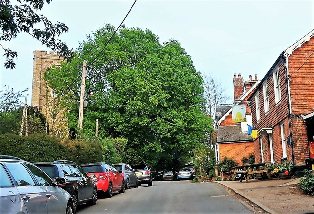
Salehurst village from Church Lane
The pub/restaurant on the right is the Salehurst Halt. The name of the public house reflects the former Salehurst Halt on the nearby Kent and East Sussex Railway which was closed in 1954.
 Map © Crown Copyright")
TIP: Click the map for more Large scale mapping
- Grid Square
- TQ7424, 212 images (more nearby 🔍)
- Photographer
- Patrick Roper (more nearby)
- Date Taken
- Thursday, 5 May, 2022 (more nearby)
- Submitted
- Thursday, 16 June, 2022
- Subject Location
-
OSGB36:
 TQ 7485 2422 [10m precision]
WGS84: 50:59.4493N 0:29.4026E - Camera Location
-
OSGB36: TQ 7475 2423
- View Direction
- EAST (about 90 degrees)