2022
NO2172 : View up Glen Cally
taken 2 years ago, 4 km NE of Auchavan, Angus, Scotland
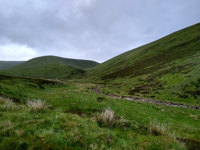
View up Glen Cally
This is the very northern end of Glen Cally, the burn to the right. It divides in two just a hundred metres further up, and then peters out. Or rather springs into existence. The same happens to the path. The spur in the middle of the image leads straight onto the Mayar plateau. Just two miles from here and you are in Corrie Fee, which seems so far away when you are walking in Glen Isla.
 Map © Crown Copyright")
TIP: Click the map for more Large scale mapping
- Grid Square
- NO2172, 5 images (more nearby 🔍)
- Photographer
- Aleks Scholz (more nearby)
- Date Taken
- Sunday, 19 June, 2022 (more nearby)
- Submitted
- Monday, 20 June, 2022
- Subject Location
-
OSGB36:
 NO 2163 7275 [10m precision]
WGS84: 56:50.3743N 3:17.1713W - Camera Location
-
OSGB36: NO 2134 7246
- View Direction
- Northeast (about 45 degrees)