2016
NY3239 : Road junction near Hodden Croft
taken 8 years ago, near to Caldbeck, Cumbria, England
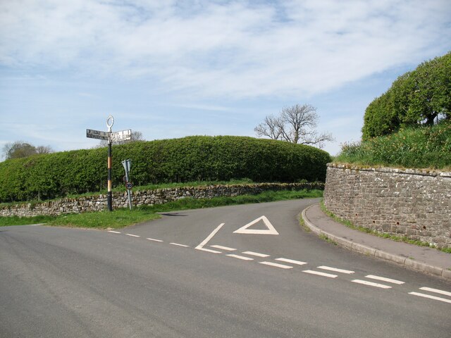
Road junction near Hodden Croft
This is where the minor road to Dye Nook and Caldbeck village green leaves the B5299. The Uldale and Bassenthwaite arm of the signpost has become turned through 90°.
Northbound walkers following The Cumbria Way long distance path cross the B5299 road here and take the minor road opposite (next photograph NY3239 : Dye Nook, Caldbeck).
Northbound walkers following The Cumbria Way long distance path cross the B5299 road here and take the minor road opposite (next photograph NY3239 : Dye Nook, Caldbeck).
The Cumbria Way
A 119km (74 mile) long distance path from Ulverston to Carlisle, through the heart of the English Lake District.
 Map © Crown Copyright")
TIP: Click the map for more Large scale mapping
- Grid Square
- NY3239, 181 images (more nearby 🔍)
- Photographer
- Adrian Taylor (more nearby)
- Date Taken
- Tuesday, 10 May, 2016 (more nearby)
- Submitted
- Wednesday, 22 June, 2022
- Subject Location
-
OSGB36:
 NY 32267 39703 [1m precision]
WGS84: 54:44.8618N 3:3.2260W - Camera Location
-
OSGB36: NY 32293 39693
- View Direction
- West-northwest (about 292 degrees)