2016
SD9517 : Rochdale Canal Feed
taken 8 years ago, near to Calderbrook, Rochdale, England
This is 1 of 2 images, with title Rochdale Canal Feed in this square
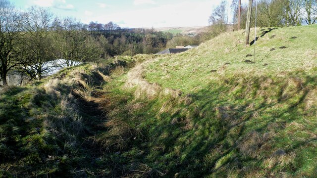
Rochdale Canal Feed
The feed from Hollingworth Lake to Summit is following the contour above Sladen Mill
 Map © Crown Copyright")
TIP: Click the map for more Large scale mapping
- Grid Square
- SD9517, 43 images (more nearby 🔍)
- Photographer
- Kevin Waterhouse (more nearby)
- Date Taken
- Sunday, 14 February, 2016 (more nearby)
- Submitted
- Monday, 27 June, 2022
- Subject Location
-
OSGB36:
 SD 9505 1735 [10m precision]
WGS84: 53:39.1574N 2:4.5820W - Camera Location
-
OSGB36: SD 9507 1734
- View Direction
- West-northwest (about 292 degrees)