2006
SJ8497 : Rochdale canal before clean up
taken 18 years ago, near to Manchester, England
This is 1 of 2 images, with title starting with Rochdale in this square
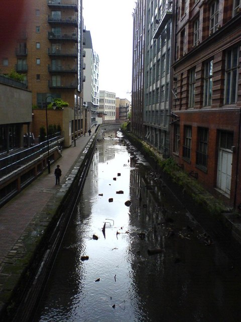
Rochdale canal before clean up
Rochdale canal, part of the Cheshire ring, taken from Oxford Street bridge, just north of Oxford Road station. On the left are modern apartments above retail premises (including a compact Sainsbury's) which front onto Whitworth Street, part of the massive urban renewal in and around central Manchester in the first decade of the 21st century. On the right are office buildings constructed in the first half of the 20th century. The canal, railway and Mancunian Way (inner city motorway) all closely follow the valley of the River Medlock around the southern edge of the city centre. The river itself flows under a bridge immediately south of the railway, which crosses Oxford Street above the river.
 Map © Crown Copyright")
TIP: Click the map for more Large scale mapping
- Grid Square
- SJ8497, 2109 images (more nearby 🔍)
- Photographer
- Antony McCann (more nearby)
- Date Taken
- Friday, 18 August, 2006 (more nearby)
- Submitted
- Tuesday, 11 March, 2008
- Subject Location
-
OSGB36:
 SJ 840 976 [100m precision]
WGS84: 53:28.4985N 2:14.4974W - Camera Location
-
OSGB36: SJ 840 976
- View Direction
- West-southwest (about 247 degrees)