2022
TV6198 : The Sussex Flag flying on Grand Parade, Eastbourne, East Sussex
taken 2 years ago, near to Eastbourne, East Sussex, England
The Sussex Flag flying on Grand Parade, Eastbourne, East Sussex
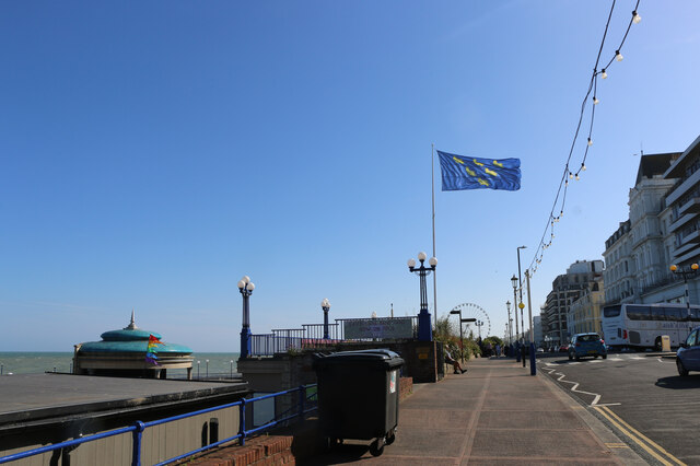
This photo shows a SW view of the Sussex Flag flying from the flagpole near Eastbourne Bandstand on Grand Parade.
The first known recording of the emblem being used to represent the county was in 1611 when cartographer John Speed used it to represent the Kingdom of the South Saxons (Sussex) in his atlas, The Theatre of the Empire of Great Britaine. The Sussex County Flag was registered on the 20th May 2011 by the Flag Institute as a traditional County Flag. This was certified by the Chief Vexillologist, Graham Bartram as a result of the campaign by the father and son partnership of Brady and David Ells, with help from the Association of British Counties.
Since 2013 the Sussex flag has been flown annually in each of the six ancient Rapes (ancient land divisions), in the week leading up to Sussex Day, 16th June. Large county flags are hoisted over the Council House in Chichester, the Town Hall in Arundel, from St Peters Church in Upper Beeding representing Bramber, from Lewes Castle, from St Nicholas Church in Pevensey, and from Hastings Castle; each representing their respective historic division of Sussex.
 Map © Crown Copyright")
TIP: Click the map for more Large scale mapping
- Grid Square
- TV6198, 1480 images (more nearby 🔍)
- Photographer
- Andrew Diack (more nearby)
- Date Taken
- Monday, 20 June, 2022 (more nearby)
- Submitted
- Monday, 11 July, 2022
- Subject Location
-
OSGB36:
 TV 6153 9861 [10m precision]
WGS84: 50:45.8760N 0:17.3467E - Camera Location
-
OSGB36: TV 6155 9862
- View Direction
- Southwest (about 225 degrees)