2022
SJ8990 : Former entrance to Stockport Bus Station
taken 2 years ago, near to Stockport, England
This is 1 of 22 images, with title starting with Former in this square
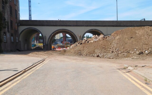
Former entrance to Stockport Bus Station
A sneaky look through the barricades at the work going on at the former bus station. Beyond the arches of Wellington Road Viaduct carrying the A6 can be seen a glimpse of the demolition work. The iconic railway viaduct is mostly hidden from view although a railway gantry can be seen top right. On the left but to the right of a crane can be seen a Manchester airport-bound plane. The building on the left has been derelict for decades.
 Map © Crown Copyright")
TIP: Click the map for more Large scale mapping
- Grid Square
- SJ8990, 2240 images (more nearby 🔍)
- Photographer
- Gerald England (more nearby)
- Date Taken
- Saturday, 16 July, 2022 (more nearby)
- Submitted
- Monday, 18 July, 2022
- Subject Location
-
OSGB36:
 SJ 8931 9027 [10m precision]
WGS84: 53:24.5480N 2:9.7365W - Camera Location
-
OSGB36: SJ 8933 9028
- View Direction
- West-southwest (about 247 degrees)