2022
SO8552 : Norton Road, St. Peter's, Worcester
taken 2 years ago, near to Whittington, Worcestershire, England
This is 1 of 3 images, with title Norton Road, St. Peter's, Worcester in this square
Norton Road, St. Peter's, Worcester
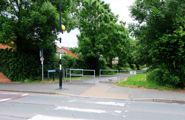
The zebra crossing in the foreground is on St. Peter's Drive. Ahead of this is part of Norton Road, which here is a footpath and cycleway. In this direction it leads to Power Park, a linear public park, and Broomhall Green, a residential road.
 Map © Crown Copyright")
TIP: Click the map for more Large scale mapping
- Grid Square
- SO8552, 114 images (more nearby 🔍)
- Photographer
- P L Chadwick (more nearby)
- Date Taken
- Saturday, 4 June, 2022 (more nearby)
- Submitted
- Tuesday, 19 July, 2022
- Subject Location
-
OSGB36:
 SO 858 524 [100m precision]
WGS84: 52:10.1970N 2:12.4812W - Camera Location
-
OSGB36: SO 858 524
- View Direction
- Southeast (about 135 degrees)