2014
SH6054 : Topograph on Snowdon Summit
taken 10 years ago, 4 km NNW of Plas Gwynant, Gwynedd, Wales
Topograph on Snowdon Summit
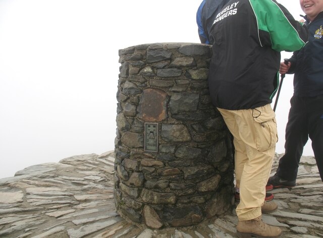
The Ordnance Survey trigonometrical column on the summit of Snowdon was demolished and replaced by a topograph; some Ordnance Survey hardware from the trigonometrical column and a meteorological station being incorporated into this. When in situ in the original Ordnance Survey column the flush bracket, benchmark number 10684, marked a height of 1086.002m above sea level (Ordnance Datum Newlyn), last levelled in 1961 (photograph SH6054 : Flush Bracket Benchmark, Snowdon Summit).
On a misty day, the three men standing idly chatting on the summit regrettably did not think that people waiting to take photographs was a good enough reason for them to consider moving politely to one side.
On a misty day, the three men standing idly chatting on the summit regrettably did not think that people waiting to take photographs was a good enough reason for them to consider moving politely to one side.
 Map © Crown Copyright")
TIP: Click the map for more Large scale mapping
- Grid Square
- SH6054, 456 images (more nearby 🔍)
- Photographer
- Adrian Taylor (more nearby)
- Date Taken
- Saturday, 16 August, 2014 (more nearby)
- Submitted
- Saturday, 23 July, 2022
- Subject Location
-
OSGB36:
 SH 60986 54375 [1m precision]
WGS84: 53:4.1084N 4:4.5734W - Camera Location
-
OSGB36: SH 60985 54374
- View Direction
- Northeast (about 45 degrees)