2022
SK7533 : Bridleway beneath a disused railway line
taken 2 years ago, near to Plungar, Leicestershire, England
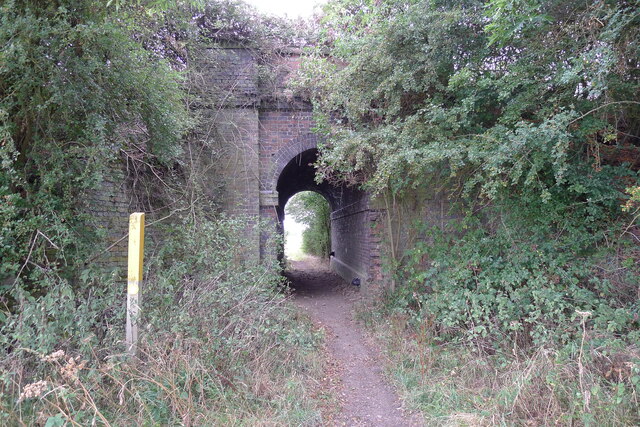
Bridleway beneath a disused railway line
Part of the Great Northern and London and North Western Joint Railway network, which was mainly used for carrying iron ore and agricultural produce Link . The bridleway is running on the Leicestershire-Nottinghamshire county boundary.
 Map © Crown Copyright")
TIP: Click the map for more Large scale mapping
- Grid Square
- SK7533, 28 images (more nearby 🔍)
- Photographer
- Tim Heaton (more nearby)
- Date Taken
- Wednesday, 3 August, 2022 (more nearby)
- Submitted
- Saturday, 6 August, 2022
- Subject Location
-
OSGB36:
 SK 7540 3363 [10m precision]
WGS84: 52:53.6904N 0:52.8395W - Camera Location
-
OSGB36: SK 7543 3365
- View Direction
- West-southwest (about 247 degrees)