2007
NG8046 : Loch na Beinne Baine
taken 17 years ago, near to A' Phoit [hill or Mountain], Highland, Great Britain
This is 1 of 2 images, with title Loch na Beinne Baine in this square
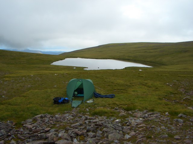
Loch na Beinne Baine
Taken after a night camping on the edge of Coir' an Fhamair.
 Map © Crown Copyright")
TIP: Click the map for more Large scale mapping
- Grid Square
- NG8046, 6 images (more nearby 🔍)
- Photographer
- John Mann (more nearby)
- Date Taken
- Tuesday, 17 July, 2007 (more nearby)
- Submitted
- Sunday, 16 March, 2008
- Subject Location
-
OSGB36:
 NG 800 462 [100m precision]
WGS84: 57:27.1575N 5:40.0848W - Camera Location
-
OSGB36: NG 802 461
- View Direction
- West-northwest (about 292 degrees)