TF3394 : St Bartholomew's church, Covenham St Bartholomew
taken 2 years ago, near to Covenham st Mary, Lincolnshire, England
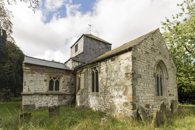
Grade II*listed
The Domesday book records two churches in Covenham, but neither have any pre-fourteenth century fabric,
although nearby excavations to the east of St Bartholomews show Saxo-norman occupation.
The church is one of two churches in Covenham, the second is St Mary's some 250 m to the south.
The current church is from the late fourteenth to early fifteenth century with a fifteenth century porch.
Originally cruciform, the original north transept was removed in the 17th or 18th century.
It was heavily restored in 1863.
The church has a nave and south porch, south transept and chancel. There is a bell turret over the east end of the nave with 3 bells..
The chancel contains a brass to Sir John Skipwith from 1415, which is in excellent condition.
The lead roof was believed to be Georgian, however the lead was stolen off the roof a few years ago and is still in need of replacement.
The fifteenth century font was removed when the church was made redundant in 1980.
Unfortunately the church is currently in poor condition.
 Map © Crown Copyright")
- Grid Square
- TF3394, 168 images (more nearby 🔍)
- Photographer
- J.Hannan (more nearby)
- Contributed by
- Julian P Guffogg (more nearby)
- Date Taken
- Saturday, 10 September, 2022 (more nearby)
- Submitted
- Saturday, 17 September, 2022
- Subject Location
-
OSGB36:
 TF 3390 9455 [10m precision]
WGS84: 53:25.8444N 0:0.8358E - Camera Location
-
OSGB36: TF 3393 9454
- View Direction
- WEST (about 270 degrees)