2022
NT2767 : A Shale Mine Woz Ere
taken 2 years ago, near to Kaimes, Edinburgh, Scotland
A Shale Mine Woz Ere
A lot of people living in West Lothian - myself included until I came across this new housing estate to the South of Burdiehouse, very close to the Edinburgh Bypass - assume that our county once had virtually all of Scotland's shale mines. I knew that there were a couple of outliers (Burntisland in Fife always stands out on the excellent ScottishShale website), but had no idea that shale mining occasionally went on in - or near to, as it would have been back then - Edinburgh.
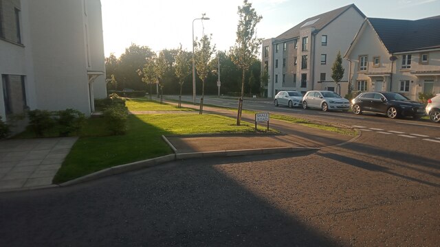
All the street names in the new estate refer to shale mining in some way, the most obvious example of which is shown directly ahead in the picture. The blurry street name on the other side of the main estate road refers to a particular seam of shale, which was tapped into at least 20 miles West of here in West Lothian - this is proved, amongst other things, by the fact that the long seam takes its name from a Mr Fell who was something to do with shale mines in or around Gavieside, a farm/settlement near West Calder. The official names of the two shale mines that were sited around here were Mortonhall No. 9 pit and Mortonhal No. 10 pit. The Mortonhall area of Edinburgh is (now at least) considerably West of here, and most well-known for its crematorium, so I'm not sure why the mines were named Mortonhall.
When delving into the history of mining online you find that mines are often referred to as being so many 'fathoms' deep. A fathom is six feet, and interestingly it is said to derive from an Old English word meaning 'outstretched arms', or possibly 'a big man's outstretched arms'.
In much the same way that the distance between the crook of a person's elbow and their inner wrist is roughly the same as the length of their foot, the distance between the middle fingers of a person's outstretched arms roughly equals their height - although of course this does differ from person to person and regionally. There are scientific papers out there that say that because people of African descent generally have an armspan greater than their height they perform better athletically.
I read somewhere too that in the unlikely event of a 107 year old having no idea of their original full height, you would simply have to measure their longer armspan to rejog their memory!
 Map © Crown Copyright")
TIP: Click the map for more Large scale mapping
- Grid Square
- NT2767, 79 images (more nearby 🔍)
- Photographer
- Ian Dodds (more nearby)
- Date Taken
- Tuesday, 13 September, 2022 (more nearby)
- Submitted
- Monday, 19 September, 2022
- Subject Location
-
OSGB36:
 NT 2756 6714 [10m precision]
WGS84: 55:53.5152N 3:9.5901W - Camera Location
-
OSGB36: NT 2756 6714
- View Direction
- West-northwest (about 292 degrees)