2022
SO6216 : Boundary Stone, Ruardean
taken 2 years ago, near to Ruardean Woodside, Gloucestershire, England
Boundary Stone, Ruardean
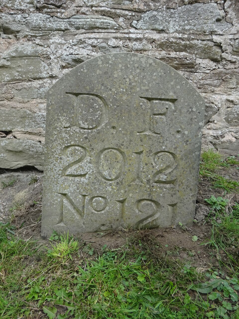
One of the many replacement boundary stone delineating the periphery of the "Forest of Dean". The "Forest" is very specific because resident have "rights in common" like grazing sheep and coal mining, though you may have to be born there to classify as a "free miner". This is on the Northern verge in Barn Lane.
Inscription: D. F. / 2012 / Nᴼ. 121
Milestone Society National ID: GL_DFDRYB121em
Inscription: D. F. / 2012 / Nᴼ. 121
Milestone Society National ID: GL_DFDRYB121em
National Survey of Wayside Features by The Milestone Society
These images are from Link
Forest of Dean Boundary Stones
a list of 100 (so far, of 200) FoD BS on Geograph see Link . An interactive map of them is Link

Some are Gale (mining rights) Stones see Facebook Link
 Map © Crown Copyright")
TIP: Click the map for more Large scale mapping
- Grid Square
- SO6216, 31 images (more nearby 🔍)
- Photographer
- Mr Red (more nearby)
- Date Taken
- Tuesday, 27 September, 2022 (more nearby)
- Submitted
- Tuesday, 27 September, 2022
- Subject Location
-
OSGB36:
 SO 62452 16806 [1m precision]
WGS84: 51:50.9147N 2:32.7898W - Camera Location
-
OSGB36: SO 62452 16806
- View Direction
- Northwest (about 315 degrees)