2022
SK5289 : Old direction sign
taken 2 years ago, near to Slade Hooton, Rotherham, England
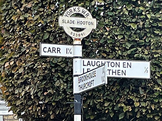
Old direction sign
Placed by the long defunct West Riding County Council and bearing the OS grid reference.
 Map © Crown Copyright")
TIP: Click the map for more Large scale mapping
- Grid Square
- SK5289, 23 images (more nearby 🔍)
- Photographer
- Graham Hogg (more nearby)
- Date Taken
- Monday, 26 September, 2022 (more nearby)
- Submitted
- Wednesday, 28 September, 2022
- Subject Location
-
OSGB36:
 SK 5229 8903 [10m precision]
WGS84: 53:23.7312N 1:12.9067W - Camera Location
-
OSGB36: SK 52280 89034
- View Direction
- EAST (about 90 degrees)