2022
SO6614 : Old Boundary Stone, Littledean Hill
taken 1 year ago, near to Cinderford, Gloucestershire, England
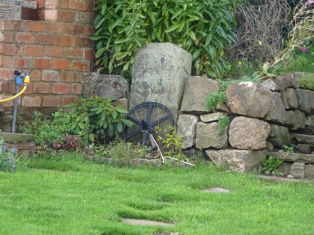
Old Boundary Stone, Littledean Hill
In the private garden of "Oak Ridge" in the Ruffitt. An original 1832 Forest of Dean boundary marker.
Inscription: D.F / 1832 / Nᴼ. 209
Milestone Society National ID: GL_DFCINLIT209em
Inscription: D.F / 1832 / Nᴼ. 209
Milestone Society National ID: GL_DFCINLIT209em
Forest of Dean Boundary Stones
a list of 100 (so far, of 200) FoD BS on Geograph see Link . An interactive map of them is Link

Some are Gale (mining rights) Stones see Facebook Link
National Survey of Wayside Features by The Milestone Society
These images are from Link
 Map © Crown Copyright")
TIP: Click the map for more Large scale mapping
- Grid Square
- SO6614, 38 images (more nearby 🔍)
- Photographer
- Mr Red (more nearby)
- Date Taken
- Thursday, 17 November, 2022 (more nearby)
- Submitted
- Thursday, 17 November, 2022
- Subject Location
-
OSGB36:
 SO 66546 14350 [1m precision]
WGS84: 51:49.6055N 2:29.2097W - Camera Location
-
OSGB36: SO 66546 14350
- View Direction
- Northwest (about 315 degrees)