2007
TL2771 : Footpath crossing floodplain at Houghton
taken 17 years ago, near to Houghton, Cambridgeshire, England
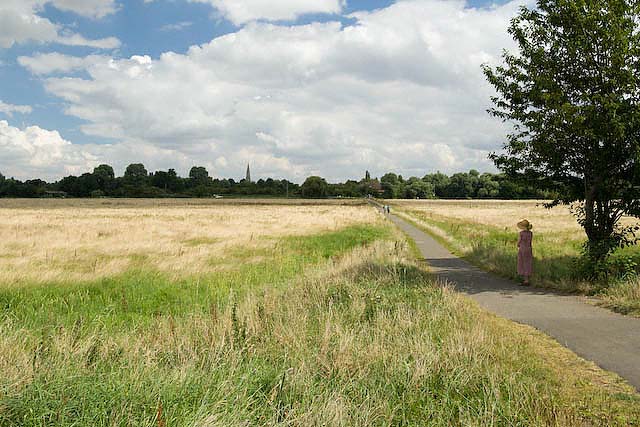
Footpath crossing floodplain at Houghton
View of the footpath and flood plain looking towards Houghton, taken from the point at which it crosses the dismantled railway track (St Ives to Huntingdon line).
 Map © Crown Copyright")
TIP: Click the map for more Large scale mapping
- Grid Square
- TL2771, 84 images (more nearby 🔍)
- Photographer
- David Bartlett (more nearby)
- Date Taken
- Tuesday, 7 August, 2007 (more nearby)
- Submitted
- Sunday, 23 March, 2008
- Subject Location
-
OSGB36:
 TL 279 717 [100m precision]
WGS84: 52:19.7416N 0:7.4462W - Camera Location
-
OSGB36: TL 278 716
- View Direction
- Northeast (about 45 degrees)