2022
SO6614 : Boundary Stone, Cinderford
taken 1 year ago, near to Cinderford, Gloucestershire, England
This is 1 of 2 images, with title Boundary Stone, Cinderford in this square
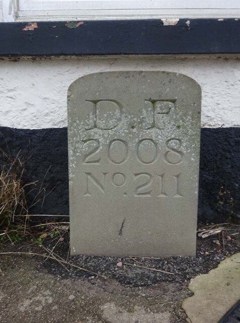
Boundary Stone, Cinderford
On the corner of Littledean Hill Road, and the chamfered corner of the former Royal Forrester pub. Technically on private land but effectively just off the road.
The context view of the ex pub is SO6614 : Former Royal Forester, Cinderford
Inscription: D.F / 2008 / Nᴼ. 211
Milestone Society National ID: GL_DFCINLIT211em
The context view of the ex pub is SO6614 : Former Royal Forester, Cinderford
Inscription: D.F / 2008 / Nᴼ. 211
Milestone Society National ID: GL_DFCINLIT211em
Forest of Dean Boundary Stones
a list of 100 (so far, of 200) FoD BS on Geograph see Link . An interactive map of them is Link

Some are Gale (mining rights) Stones see Facebook Link
National Survey of Wayside Features by The Milestone Society
These images are from Link
 Map © Crown Copyright")
TIP: Click the map for more Large scale mapping
- Grid Square
- SO6614, 38 images (more nearby 🔍)
- Photographer
- Mr Red (more nearby)
- Date Taken
- Thursday, 17 November, 2022 (more nearby)
- Submitted
- Friday, 18 November, 2022
- Subject Location
-
OSGB36:
 SO 66467 14299 [1m precision]
WGS84: 51:49.5777N 2:29.2782W - Camera Location
-
OSGB36: SO 66467 14299
- View Direction
- West-southwest (about 247 degrees)