SX9588 : Rainbow over M5 viaduct and River Exe
taken 1 year ago, near to Topsham, Devon, England
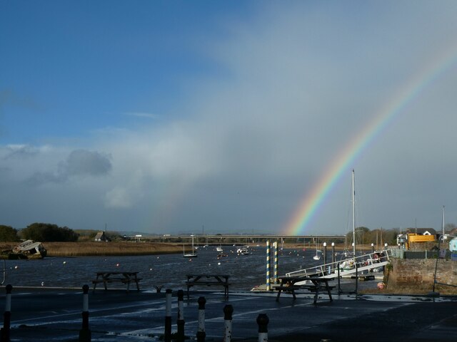
The River Exe rises on Exmoor and flows south to Exeter and The English Channel. Its estuary is a good example of a Ria (flooded river valley). It is tidal to Countess Wear, just south of Exeter SX9390 : Countess Weir, River Exe. More information Link

The M5 runs 163 miles from a junction with the M6 at West Bromwich near Birmingham to Exeter in Devon. Constructed between 1962 & 1977. It links the North and Midlands with the South west. Link
Topsham is a large village / small town on the Exe Estuary just south of Exeter. The town has a long history, it was a Celtic settlement, then the Roman port for Exeter. It was an important Saxon settlement and the church dates from the 10th century. It remained a port until the 19th century. The town has a variety of interesting architectural styles and numerous Listed buildings. Link
Wikipedia: Link
Website: Link
 Map © Crown Copyright")
- Grid Square
- SX9588, 173 images (more nearby 🔍)
- Photographer
- David Smith (more nearby)
- Date Taken
- Friday, 18 November, 2022 (more nearby)
- Submitted
- Thursday, 24 November, 2022
- Subject Location
-
OSGB36:
 SX 9559 8887 [10m precision]
WGS84: 50:41.4048N 3:28.7696W - Camera Location
-
OSGB36: SX 9656 8786
- View Direction
- Northwest (about 315 degrees)