2022
SP0786 : Carrs Lane Church, Birmingham: history
taken 1 year ago, near to Birmingham, England
This is 1 of 4 images, with title starting with Carrs Lane in this square
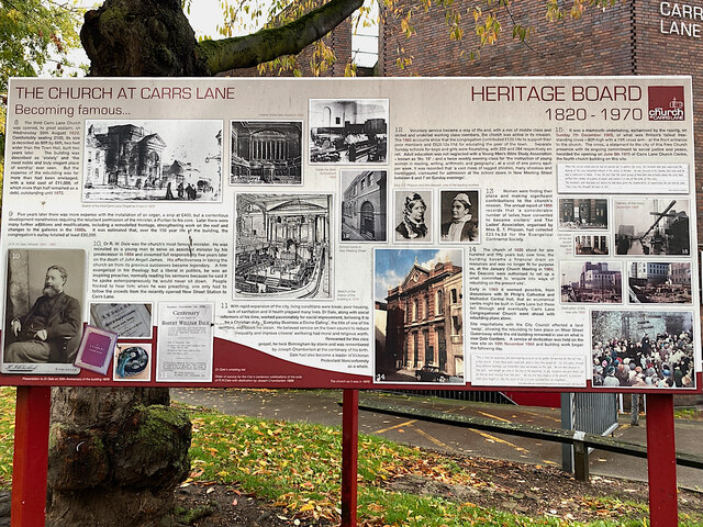
Carrs Lane Church, Birmingham: history
To see this in more detail click 'More Sizes' at upper right.
 Map © Crown Copyright")
TIP: Click the map for more Large scale mapping
- Grid Square
- SP0786, 1813 images (more nearby 🔍)
- Photographer
- Robin Stott (more nearby)
- Date Taken
- Friday, 21 October, 2022 (more nearby)
- Submitted
- Thursday, 24 November, 2022
- Subject Location
-
OSGB36:
 SP 0733 8685 [10m precision]
WGS84: 52:28.7717N 1:53.6101W - Camera Location
-
OSGB36: SP 0733 8685
- View Direction
- Northeast (about 45 degrees)