2022
SD6178 : River Lune and Devil's Bridge, Kirkby Lonsdale
taken 1 year ago, near to Kirkby Lonsdale, Cumbria, England
This is 1 of 46 images, with title starting with River Lune in this square
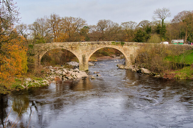
River Lune and Devil's Bridge, Kirkby Lonsdale
Devils Bridge crossing the River Lune at Kirkby Lonsdale, is regarded as one of the finest mediæval bridges still existing in England Link . In common with many bridges of the same name Link legend* has it that the bridge was built by Satan himself but It was probably built sometime in the late 14th or early 15th century by the monks of St Marys Abbey in York. The date is uncertain as all early records in York were lost during the Civil War. The bridge carried the Kendal to Skipton road until the 1930s when it was replaced with the Stanley Bridge, 150 metres to the south. It is a Grade I listed building (List entry Number: 1086899 Link Historic England), now open only to pedestrians.
*The local legend is that the Devil appeared to an old woman, promising to build a bridge in exchange for the first soul to cross over it, thinking that it would be the woman herself. When the bridge was finished, the woman threw bread over the bridge and her dog chased after it, thereby outwitting the Devil.
See other images of Devil's Bridge, Kirkby Lonsdale
 Map © Crown Copyright")
TIP: Click the map for more Large scale mapping
- Grid Square
- SD6178, 784 images (more nearby 🔍)
- Photographer
- David Dixon (more nearby)
- Date Taken
- Sunday, 27 November, 2022 (more nearby)
- Submitted
- Wednesday, 30 November, 2022
- Subject Location
-
OSGB36:
 SD 615 782 [100m precision]
WGS84: 54:11.9025N 2:35.4429W - Camera Location
-
OSGB36: SD 615 781
- View Direction
- NORTH (about 0 degrees)