2022
ND0169 : Gie-uisg Geo
taken 1 year ago, near to Crosskirk, Highland, Scotland
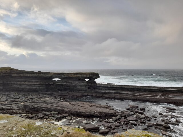
Gie-uisg Geo
The O.S Name Book from 1871 - 1873 suggests this was once used as a haven or harbour for boats.
The holes in the layered sedimentary rock are interesting.
The holes in the layered sedimentary rock are interesting.
 Map © Crown Copyright")
TIP: Click the map for more Large scale mapping
- Grid Square
- ND0169, 7 images (more nearby 🔍)
- Photographer
- David Bremner (more nearby)
- Date Taken
- Tuesday, 6 December, 2022 (more nearby)
- Submitted
- Tuesday, 6 December, 2022
- Subject Location
-
OSGB36:
 ND 01055 69485 [1m precision]
WGS84: 58:36.1206N 3:42.2630W - View Direction
- West-northwest (about 292 degrees)