2010
NN5726 : Glen Ogle Viaduct by A85 half way up Glen Ogle
taken 14 years ago, 3 km from Lochearnhead, Stirling, Scotland
Glen Ogle Viaduct by A85 half way up Glen Ogle
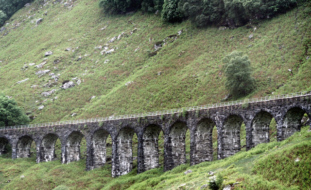
Twelve-arch Glen Ogle Viaduct built by John Strain, circa 1866. The viaduct, comprising twelve segmental arches with sturdy tapered piers, formerly carried the Callander and Oban Railway over open ground in the east flank of Meall Reamhar. It was 139ft long overall and 44ft high with a single track. It now carries the official footpath, Rob Roy Way. A three-arched bridge (Glen Ogle Small Viaduct) forms the southward continuation viaduct. The railway received Royal assent on 5th July 1865. The contract for this section was let to J McKay and it opened in August 1868. The line closed here in 1965 following the Glen Ogle Rockfall not far south of the viaduct.
 Map © Crown Copyright")
TIP: Click the map for more Large scale mapping
- Grid Square
- NN5726, 91 images (more nearby 🔍)
- Photographer
- Jo and Steve Turner (more nearby)
- Date Taken
- Sunday, 13 June, 2010 (more nearby)
- Submitted
- Monday, 19 December, 2022
- Subject Location
-
OSGB36:
 NN 5706 2643 [10m precision]
WGS84: 56:24.5044N 4:19.0889W - Camera Location
-
OSGB36: NN 5711 2675
- View Direction
- SOUTH (about 180 degrees)