2022
SH6544 : Yr Moelwyniau, Eryri
taken 1 year ago, 3 km from Croesor, Gwynedd, Wales
This is 1 of 3 images, with title Yr Moelwyniau, Eryri in this square
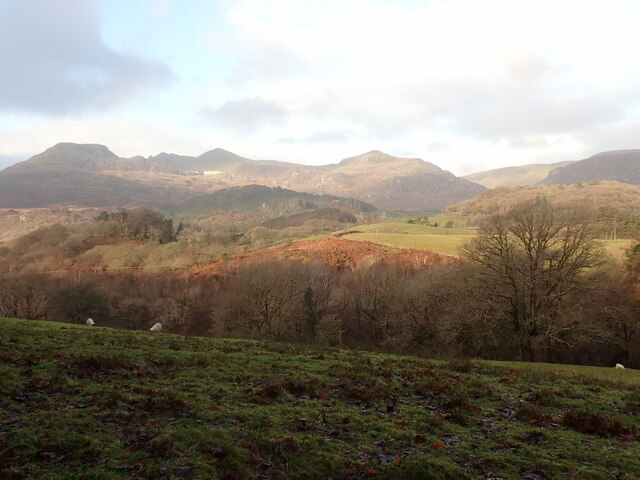
Yr Moelwyniau, Eryri
Four peaks of the Moelwyns: Moelwyn Bach (710m), Craigysgefn (689m), Moelwyn Mawr (770m) and Moel-yr-Hydd (647m), and the dam of Llyn Stwlan (that feeds the pumped-storage hydroelectric Ffestiniog Power Station down below in Tanygrisiau). Ref:PC200044u.
 Map © Crown Copyright")
TIP: Click the map for more Large scale mapping
- Grid Square
- SH6544, 37 images (more nearby 🔍)
- Photographer
- Phil Brandon Hunter (more nearby)
- Date Taken
- Tuesday, 20 December, 2022 (more nearby)
- Submitted
- Thursday, 29 December, 2022
- Subject Location
-
OSGB36:
 SH 6581 4486 [10m precision]
WGS84: 52:59.0537N 4:0.0189W - Camera Location
-
OSGB36: SH 70502 42821
- View Direction
- West-northwest (about 292 degrees)