2022
TQ5926 : Mayfield 90 Public Footpath
taken 1 year ago, near to Mayfield, East Sussex, England
Mayfield 90 Public Footpath
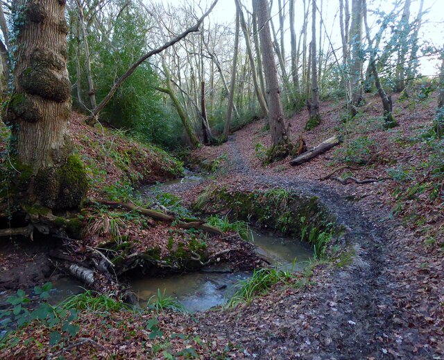
This is a new public footpath, it was not marked on my old Explorer Map that was purchased way back in 2006, that links Mayfield 12 and Mayfield 13 public footpaths forming a loop that remains close to the village centre. It follows the course of an unnamed stream that is a tributary of the River Rother and is it is a new path is pretty precarious in places especially with the amount of mud.
 Map © Crown Copyright")
TIP: Click the map for more Large scale mapping
- Grid Square
- TQ5926, 35 images (more nearby 🔍)
- Photographer
- Simon Carey (more nearby)
- Date Taken
- Thursday, 29 December, 2022 (more nearby)
- Submitted
- Saturday, 31 December, 2022
- Subject Location
-
OSGB36:
 TQ 5901 2625 [10m precision]
WGS84: 51:0.8191N 0:15.9257E - Camera Location
-
OSGB36: TQ 5900 2625
- View Direction
- Southeast (about 135 degrees)