2023
TM4575 : The former location of the bridge over the railway
taken 1 year ago, near to Blythburgh, Suffolk, England
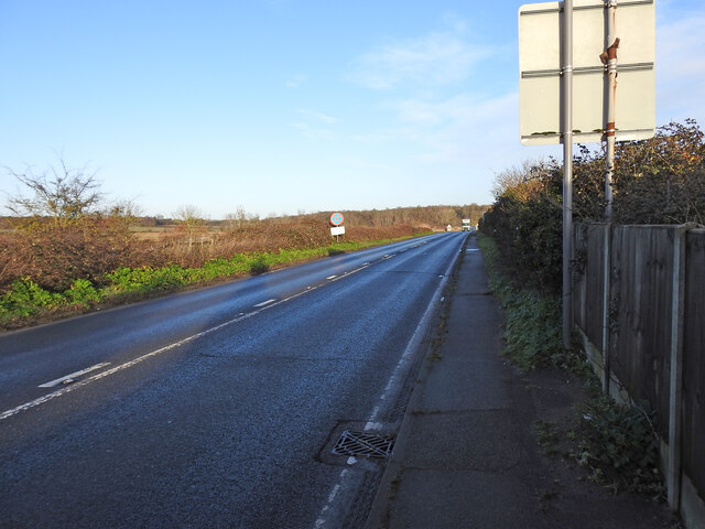
The former location of the bridge over the railway
The railway line ran the other side of the clearway sign and directly into Blythburgh station TM4575 : Reconstruction of Blythburgh station in progress
The bridge was designated #11, was a girder bridge with brick abutments having a 29 foot span over the railway, carrying what was at the time known as the Yarmouth Turnpike, since renamed the A12.
Originally described as a humpback bridge it was built over the Southwold railway in 1879 and rebuilt in 1907 with a wider span to facilitate the proposed second railway track, which never materialised.
Southwold Railway line
For a photographic journey from Southwold to Halesworth visit Link
 Map © Crown Copyright")
TIP: Click the map for more Large scale mapping
- Grid Square
- TM4575, 356 images (more nearby 🔍)
- Photographer
- Adrian S Pye (more nearby)
- Date Taken
- Monday, 9 January, 2023 (more nearby)
- Submitted
- Monday, 16 January, 2023
- Subject Location
-
OSGB36:
 TM 4526 7548 [10m precision]
WGS84: 52:19.3542N 1:35.8546E - Camera Location
-
OSGB36: TM 4527 7545
- View Direction
- North-northwest (about 337 degrees)