2023
SN7042 : Llwybr ar Fynydd Mallaen / A path on Mynydd Mallaen
taken 1 year ago, near to Cwrt-y-Cadno, Carmarthenshire/Sir Gaerfyrddin, Wales
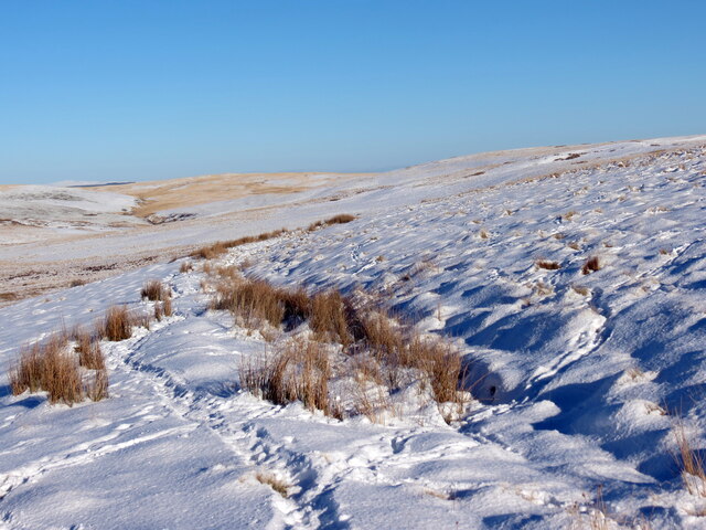
Llwybr ar Fynydd Mallaen / A path on Mynydd Mallaen
Er bod y llwybr yn anodd i'w weld ar y ddaear oherwydd yr eira mae'r brwyn yn dynodi'i hynt.
Although the path is difficult to see on the ground due to the snow the rushes reveal its course.
Although the path is difficult to see on the ground due to the snow the rushes reveal its course.
 Map © Crown Copyright")
TIP: Click the map for more Large scale mapping
- Grid Square
- SN7042, 8 images (more nearby 🔍)
- Photographer
- Alan Richards (more nearby)
- Date Taken
- Friday, 20 January, 2023 (more nearby)
- Submitted
- Saturday, 21 January, 2023
- Subject Location
-
OSGB36:
 SN 7046 4229 [10m precision]
WGS84: 52:3.8276N 3:53.4646W - Camera Location
-
OSGB36: SN 7039 4226
- View Direction
- East-northeast (about 67 degrees)