2023
NY9841 : Course of horizontal flue from Stanhope Smelt Mill (lead)
taken 1 year ago, near to Crawleyside, County Durham, England
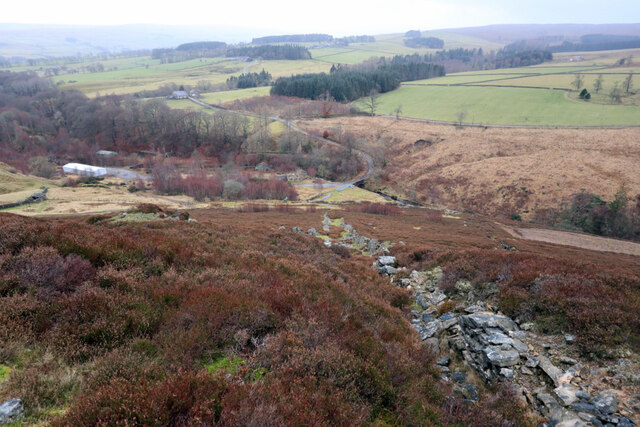
Course of horizontal flue from Stanhope Smelt Mill (lead)
Stanhopeburn Mine was a large lead mining complex dating back to at least 1830. The mining of galena from the Red Vein ended here in 1875, but fluorspar extraction continued until the mine closed in 1982. The flues on the hillside above the mine were associated with a lead smelt mill once situated on the site. These channelled and condensed toxic fumes released by the smelting process. Remaining fumes were carried to a chimney high on the hillside.
See other images of Stanhope Lead Mine & Smelt Mill
See other images of Stanhope Lead Mine & Smelt Mill
 Map © Crown Copyright")
TIP: Click the map for more Large scale mapping
- Grid Square
- NY9841, 86 images (more nearby 🔍)
- Photographer
- Andrew Curtis (more nearby)
- Date Taken
- Wednesday, 25 January, 2023 (more nearby)
- Submitted
- Wednesday, 25 January, 2023
- Subject Location
-
OSGB36:
 NY 9874 4155 [10m precision]
WGS84: 54:46.1324N 2:1.2664W - Camera Location
-
OSGB36: NY 98798 41581
- View Direction
- West-southwest (about 247 degrees)