2015
SJ9621 : Flood plain and woodland south-east of Stafford
taken 9 years ago, near to Milford, Staffordshire, England
This is 1 of 2 images, with title Flood plain and woodland south-east of Stafford in this square
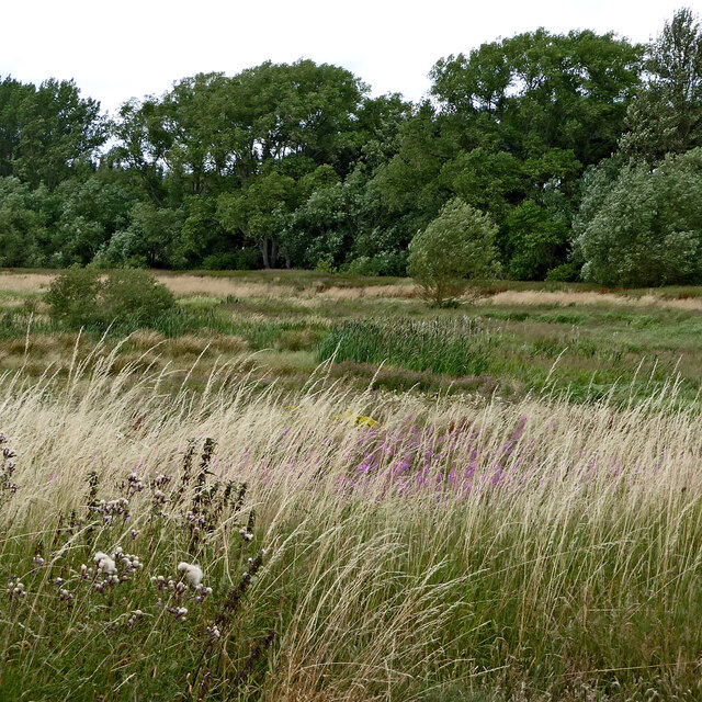
Flood plain and woodland south-east of Stafford
Looking across the marshy River Sow floodplain from the Staffordshire and Worcestershire Canal, the colours of the vegetation change constantly through the seasons. There are marshy areas and some pools, but occasionally during settled summer weather some cattle are allowed to graze.
 Map © Crown Copyright")
TIP: Click the map for more Large scale mapping
- Grid Square
- SJ9621, 188 images (more nearby 🔍)
- Photographer
- Roger D Kidd (more nearby)
- Date Taken
- Tuesday, 4 August, 2015 (more nearby)
- Submitted
- Friday, 27 January, 2023
- Subject Location
-
OSGB36:
 SJ 9698 2146 [10m precision]
WGS84: 52:47.4420N 2:2.7734W - Camera Location
-
OSGB36: SJ 9701 2137
- View Direction
- North-northwest (about 337 degrees)