2023
SO5986 : Ruined stone crushing plant on Brown Clee Hill
taken 1 year ago, near to Abdon, Shropshire, England
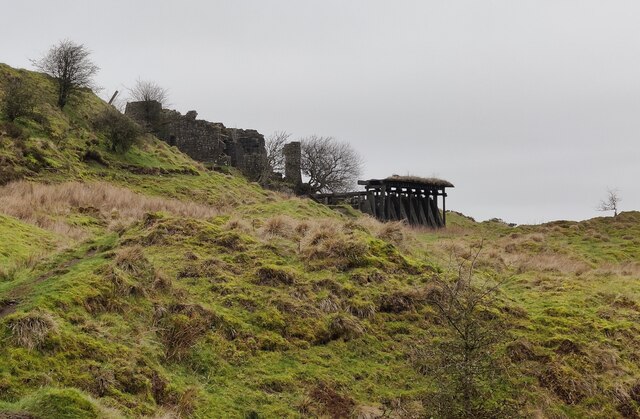
Ruined stone crushing plant on Brown Clee Hill
Brown Clee Hill is the highest hill in Shropshire, at 540 metres (1,770 ft) above sea level. It is part of the Clee Hills and is in the Shropshire Hills Area of Outstanding Natural Beauty. Brown Clee Hill lies five miles north of Titterstone Clee Hill.
There were three Iron Age hill forts at Brown Clee, the two at Abdon Burf and Clee Burf have been largely lost to quarrying activity, the hill fort at Nordy Bank is still intact.
Dhustone (Dolerite) was quarried in the area for many years, the Abdon Clee quarries closed in 1936.
Several air traffic control radar masts are on the summit of the hill, and a toposcope is sited at the summit.
See other images of Brown Clee Hill
 Map © Crown Copyright")
TIP: Click the map for more Large scale mapping
- Grid Square
- SO5986, 217 images (more nearby 🔍)
- Photographer
- Mat Fascione (more nearby)
- Date Taken
- Saturday, 28 January, 2023 (more nearby)
- Submitted
- Saturday, 28 January, 2023
- Subject Location
-
OSGB36:
 SO 5969 8678 [10m precision]
WGS84: 52:28.6470N 2:35.6955W - Camera Location
-
OSGB36: SO 5975 8670
- View Direction
- Northwest (about 315 degrees)